Up and Down, North to South
13 Dec
Previous Trail Posts
The Path of Electrical Storms The Day I Left Photo Log: Forms and Shapes
________________________________________________________
I’m running as fast as I can.
This sub-alpine plain between Forester Pass and Tyndall Creek is covered in black clouds, a rock path and very few trees. Lightning hits a second or so away. I’m headed briskly toward a Lodgepole pine standing starkly in contrast to the horizontal lines of yellow grass and gray. Been closing in on it for 15 minutes it seems. It’s been 2.5 days since Lake Marjorie, and the storms have stayed with me since.
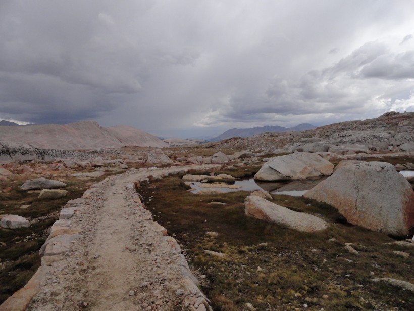
I'm running as fast as I can. Forester behind me, the last mountain crest in front of me. Not one tree in sight.
The one redeeming value of my bivy sack has now been made evident to me. What it lacks in comfort, it makes up for in pure convenience. 80 seconds after rain begins to fall, my gear and I are sealed dryly inside, wrapped along the broadside of the shelter tree while flashes of blue paint the afternoon sky. I was a day away, less than 20 miles from the summit of Mt. Whitney.
###
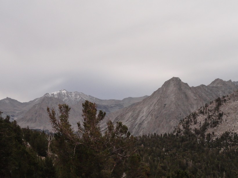
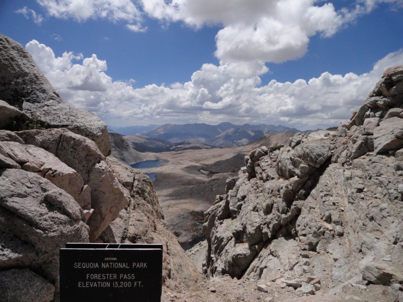
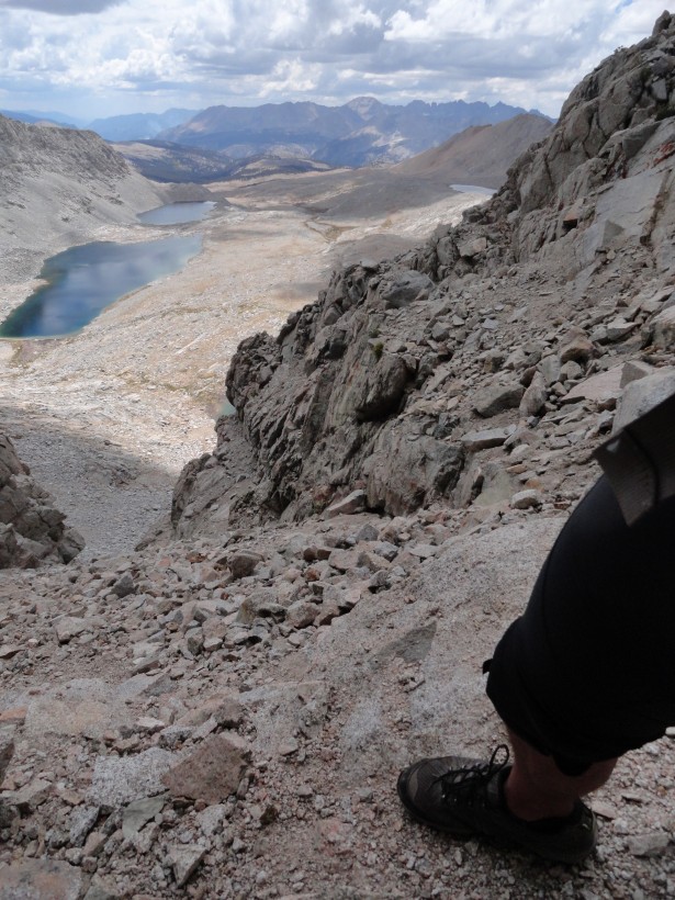
Yesterday I crossed Pinchot Pass, then bagged only 13 miles or so to camp at Rae Lakes for 10 hours under the worst hail and thunderstorm of my life (another story altogether that I cannot bring myself to tell quite yet). Today, I got an early start, a sunrise greets me from the top of Glen Pass (11,926 ft.) – then a steep trip down to the valley at 8000 ft. – then back up to the top of Forester Pass (13180 ft) before noon. The clouds are already forming around me. 2000 ft. below, scattered Lodgepole pines dot a barren plateau that stretches south to a vast congregation of mountain tops, that are both ominous and beautiful, in only the way the Sierras can be. Somewhere in that collection of peaks is Whitney. Forester Pass is been the highest point yet, and yet I’m immediately reminded it’s a good 1500 below my end goal.
I suppose I deliriously imagined that the storm was pursuing me in some respect. I certainly attributed to it a conscience and purpose that made very logical sense to me, but looking back I can’t really explain why that was so. Some things about my time on the trail aren’t clear to me even now. Today, sitting from my office desk, much of my time is a vignette that fades in on itself into background without a definite border.
The tree offers more of a figurative shelter than an actual one. (And being the only tree, perhaps it serves an even less than neutral purpose.) I examined my map to gauge the best place to make camp. Tyndall Creek was 2 miles away, and in a basin, which meant more cover, water and likely a campground. I still don’t know what I am doing out here, but I’ve found my rhythm. I was owning my experience and carving my way. That has been enough for me up till now. Lighting cracks outside. The last bolt was 5 minutes ago. Hail stopped. Time to get moving again, whatever time it is.
###
12 hours later, I’m breaking camp. At sunrise. Again. It rained off and on all night, and my sealed bivy filled with condensation. I don’t want to take the time to wait for the sun to dry my gear out. It’s all laying over a bush while I cook my penultimate oatmeal packet on my small camp stove. Everything in my food canister has started to gather a smell and taste of cocoa, spices and fruit. I have one plastic spoon that I use for stirring-scooping-eating soup, cocoa, coffee and breakfast. All I know is, I’m focused on getting to the base of Mt. Whitney by noon today. If the storms relax, I could very well be up to the top and in Lone Pine this evening for a huge pizza. It wouldn’t even be my longest day hiking.
Very reasonable. I woke up feeling like everything would be just fine.
(Next post on Jan 1, 2014)
__________________________
Want to read more? View My Previous Trail Posts

Hey there bub….I can only say wow what an experience. I think of you often on that long two weeks, of pushing and testing of yourself. Whenever I am cold or tired I think how could Christopher muster up all that courage and strength to accomplish this. I see you evolving in memories of this experience and new insights into it.
You re an amazing person and your character is a
thing to behold…..
Love, mom