John Muir Trail: The Path of Electrical Storms
11 Sep
My fellow hikers would probably say I’d spent most days on the John Muir Trail breaking camp early and hiking briskly uphill, then, stopping for hours to perch on some rock to read and make coffee. This afternoon, I was reading near the banks, where two rivers met. I’d only brought a few pages from two authors. I was reading some pages I never had before, searching for something I didn’t know how to find. My fingers were sunburned with dirty nails. My dry hands rubbed roughly on the paper. The rivers’ confluence created rapids and welcome white noise as I turned the pages. Earlier today I’d followed one of these rivers from the north and above, after crossing the Upper Basin.
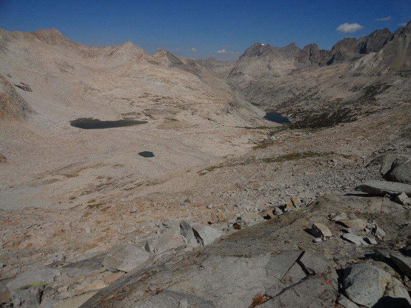
The Upper Basin was different than any terrain so far. The high desert, just south of Mather Pass, was a stark contrast to the morning climb. This was a welcome flatness, with even a slightly downward slope. Split Mountain followed me to my left for two hours as I inched downward. At about 14,000 feet, Split Mountain is just slightly shorter than Whitney. But it wasn’t so high above me, now that I was regularly hiking above 10,000 ft, where the passenger airplanes sound twice as close and the clouds loom twice as big. Where the sun sets for twice as long because it drops below the peaks well before it passes under the horizon, building vast variegated stretches that grow darker from west to east.
But this late afternoon, the sky was increasingly cumulus-covered. Colors replaced by shades of slate, charcoal and black. Humid winds increasingly swept toward me at a sharp vector down and away from the direction of the storm. Dropping downward, dry grass was replaced by shrubs, then low trees became thick woods as I followed the river to a confluence. Here it was sheltered, and I decided to stop and wait for my fellow hikers. I opened my bag to pull out my book, some trail mix and the last of my oat bars, which my wife Tosca had made for me over a month ago. I would read while I waited at the intersection of two rivers.
I was at a turning point on my hike. From here, it would take another good 4 days to get to the end of the trail, and a solid 3 days to get back to the last outpost at Muir Ranch. I’d climbed the highest peaks thus far without too much trouble, and felt confident about being able to physically finish the rest of the trip. Mentally, I’d already left behind certain demons. I’d abandoned technology and embraced a much simpler way of moving through my days. And though I was arriving at what I wanted, my heart still scrabbled up the trail.
Over several hours, the thunder kept rolling in. Black clouds to the south. My friends not yet arrived from the north. Pellets of rain came and went as I watched various groups of hikers pick out nice spots in the campgrounds around me. As I read, I was increasingly aware of sounds of unbuckling, letting packs thud to the dirt, striking propane fires, ripstop nylon unfurling, zipping and chuckling and unzipping, and eating soup in warm hoodies and long johns. I was alone, and waiting for something. I was watching clouds roll in and waiting. I read a passage:
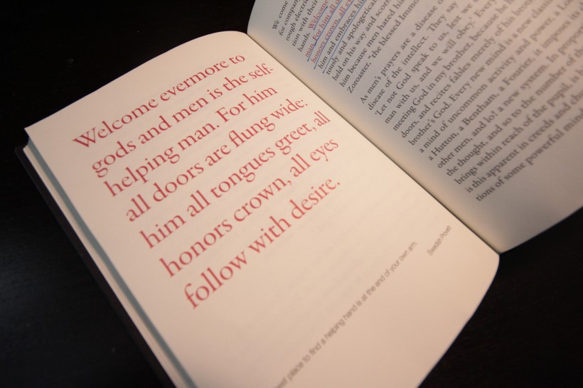
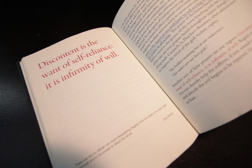
Discontent is the want of self-reliance: it is infirmity of will…We sit down and cry for company, instead of imparting to them truth and health in rough electric shocks, putting them once more in communication with their own reason. The secret of fortune is joy in our hands. Welcome evermore to gods and men is the self-helping man. For him all doors are flung wide;”
- Self Reliance, Emerson
I stared into the black above the mountains. This is where my path led me and I was reluctant to go there. I didn’t know why. I was reluctant to get struck by lightning. I was reluctant to get farther away from these campsites, from my fellow companions and the warm sense of otherness that had seemed to make the trip bearable up until now. I was reluctant to be alone, of going alone. I did not know why I had flown 3000 miles, drove 300 and hiked another 20o to come out here and help myself. But for all those reluctances, I was more afraid of waiting at a confluence of two rivers, waiting for someone else to show up, discontent, for the rest of my life. I had to help myself. I couldn’t finish this hike without finding my own path. Truth and health in rough electric shocks were waiting for me somewhere up above.
I tucked my map to the side pocket of my pack, laced my shoes and took one more long stare north. The moment I started hiking south, the trail moved steeply back uphill. The rain started falling and the wind poured over the mountain in advance of the darkest storm front I’ve ever seen. Every step I took made the idea to head out alone seem worse and worse. I climbed the 3/4 mile hill in about 15 minutes, arriving at a plateau of green grass giving stark contrast to the dark gray sky. Lake Marjorie was a 1/4 mile across this stretch. Completely drenched, I ran across as fast as one can with a 20lb pack bouncing awkwardly, the weight shifting out of rhythm to my stride.
As lightening began to strike some ways off, I arrived at a strand of trees and yellow grasses on the banks of Lake Marjorie, a green and soft lake below Mt. Pinchot. I found a semi-circled spot beneath some gnarled pines that created a bit of a windbreak. I dropped my bag. I stared at the storm. Then, I glared at it. I’m unsure why I did it, but I stood there in wet clothes and glared as the storm roared at me and blue flashes of light covered the peaks behind Pinchot. There was nothing out there but beautiful, and I had chose this.
I watched as the clouds above me split apart. As if pulled on a seam, the clouds curved around the spot where I stood. I saw hail and rain falling to my left and right, maybe 200 yards away. Yet above me was clear blue sky and a few misty white clouds. Thunder followed the lightening by about 3 seconds. Technically, the storm was more or less right overhead. But at the center of the storm, a beam of sunlight shone through drying my spot on the Earth. I had a moment of relief to get set. Too close to run away, I was content that the trees would be good enough protection. I couldn’t have timed it any better or worse. Fortune and joy.
I threw open my bivy sack and tossed all my belongings inside. I pulled on my warm pants, gloves and started the stove. Legs inside the warmth of my sleeping bag, I quickly cooked the last of my Knorr soup. I gave it 2 minutes to boil and cook, ate it quite al dente and finished the rest of my water. The sky above me was sewn up again, and I calmly/quickly tidied up the rest of my belongings and placed them in the bivy. Hail came first, then rain as I sealed myself inside. I was not invincible, I simply was here by choice: with my pack beneath my legs and my supplies to the windward side, hail pummeling the nylon inches from my head, blue light and thunder roaring me to sleep.
I was alone with my choices and extremely located for the first time in a long while. This is exactly what I was looking for. I was content, and so, drifted off to the first good night sleep on the trail so far.
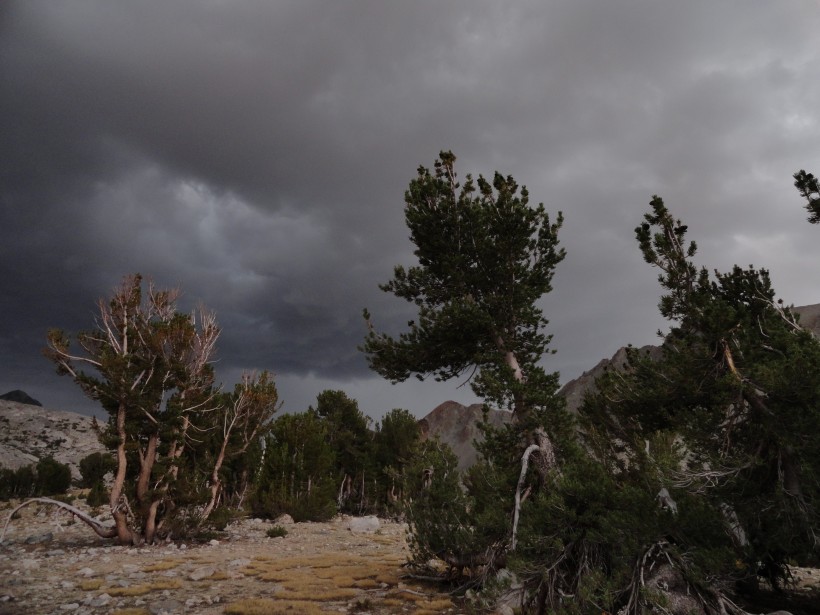
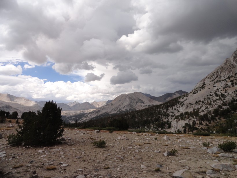
Photo from my campsite at Lake Marjorie. Lake to the right out of view. Pinchot Pass in the distance. Clouds closing in.
Here’s a gmap of this section of the hike, from Mather to Marjorie.
If you missed the first post, you can read it here.
More photos here.

